In the forestry area, UAV Surveying and Comecor Topography provides different services, always adapting to the needs of its clients and the market in general; is a provider of quality information that adds value to forestry production systems in their different stages, adapting to the particular needs of our clients.
The objective in this stage is to express through a layer of polygons, the effective planting area, adjusting its geometry to the area that we are going to evaluate using photo-interpretation techniques and avoiding unproductive areas, for example: rocky outcrops, internal roads or presence of native species.
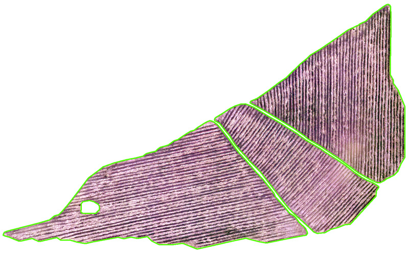
The Rodalization is carried out with the criteria of delimitation of the stand proposed by the client.
Picture 1: Stands in the sample area of a farm.
Radiometric Study:
Various image classification techniques are used, adapted to the needs of each particular project.
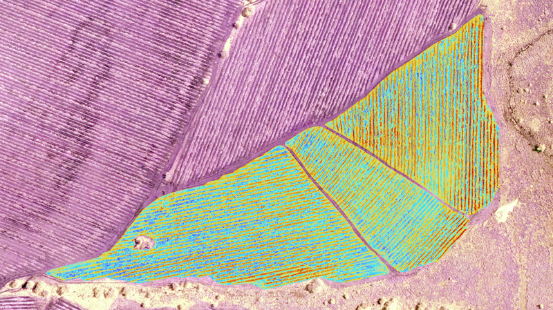
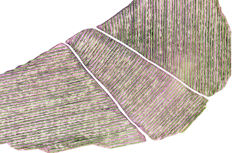
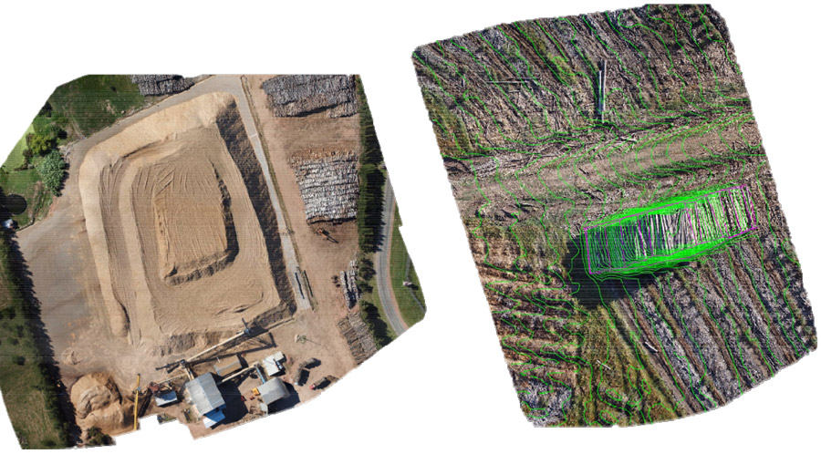
From this information the planting lines are extracted, an adjustment algorithm is used by means of which the central line that passes through the planting lines and the spatial relationships between them are obtained.
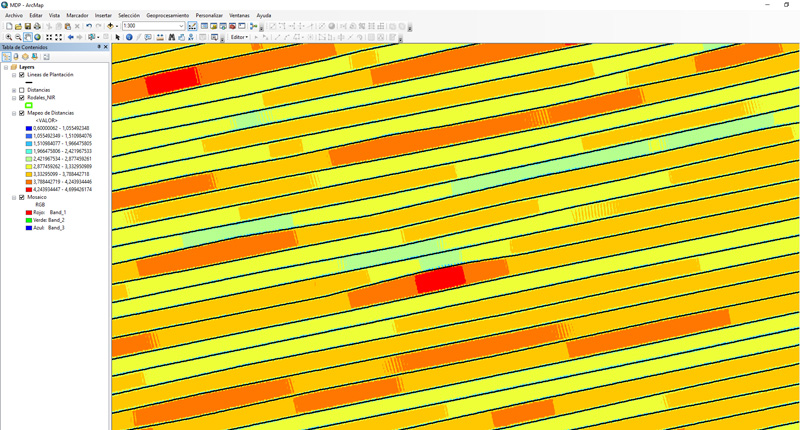
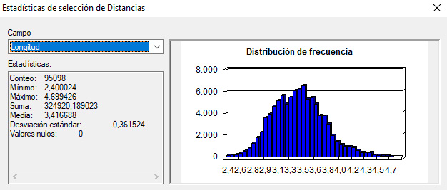
Subsequently, a statistical study is carried out, obtaining:
A table with statistical information on the field in general or on the work unit most in line with the project.
A "raster data set" containing information with the same spatial resolution of the mosaic.
A map represents the distances between the plantation lines, symbolized in a color scale where the maximum and minimum values are observed.
In it, the areas that are outside the planned range can be quickly identified on the image.
Picture 4: Mapping of lengths between planting lines.
Cartography services in general:
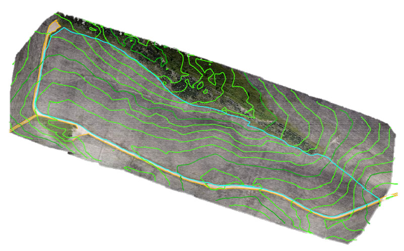
Contour lines, roads, paddocks, ravines and any element of interest for forestry projects.
Picture 5: Contour extraction on the ground.
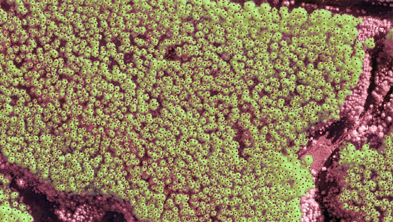
Forest census:
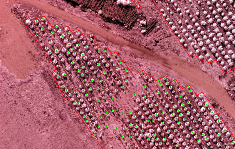
Automatic crown count in young plantations (from 6 to 18 months) for survival control.
The automatic cup counting is carried out based on the company’s own developments, today an accuracy of 98% is achieved in the census. Each automatic cup counting job is delivered with a quality control that certifies the percentage of accuracy of the count.
Picture 6: Automatic cup counting.
Picture 7: Census of forest individuals
As in the study between the plantation lines, once we have the tree count done, we undertake the statistical study to obtain the distance between trees of the same plantation line, calculation of population density and everything that the forest producer needs. for your evaluation.
Control and follow up: Services
Services in adult plantations:
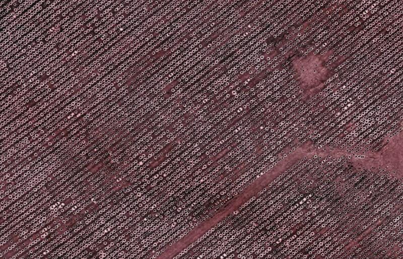
The automatic counting of crowns in adult trees is carried out from 10 cm pixel mosaics at ground level and with an infrared sensor.
The accuracy in the automatic count in adult trees is delivered with an accuracy environment between 96% to 98%.
With automatic counting and terrain elevation data, the height of each individual can be processed. This data can be delivered to the client as additional data in the point count shapefile or it can be delivered in the agreed format.
Picture 8: Automatic counting of adult individuals
Picture 9: Calculation of Crown Areas
Calculation of Crown Areas:
Automatic Rodalization of the forested area is a self-developed product based on the vegetation index and image classification techniques.
The data of the canopy area are combined with those of the height of the individuals, in order to establish production indices.
Post- Harvest: Services
Volumetric calculations:
We carry out volume calculations in stockpiles, both in chips and in stockpiles of logs.